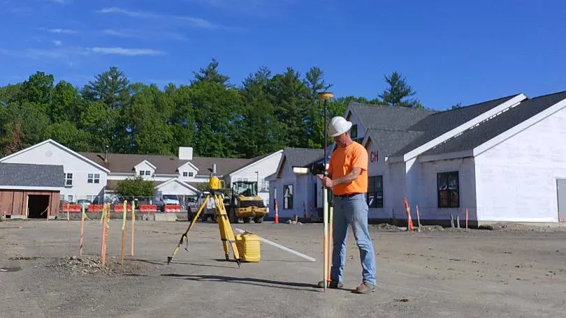
At 3D SEA LLC, we deliver comprehensive field survey services designed to support every phase of your site development and construction projects. Our skilled survey teams harness the latest GPS surveying technologies to provide accurate setup, precise stakeout, and reliable as‑built data collection. From initial system localization to final point capture, we ensure your field operations run smoothly and on schedule.
1. GPS System Setup & Localization
Successful field surveying begins with a ‘tight’ and accurate GPS foundation. Our technicians handle:
- Initial Setup: Setup of an onsite receiver base station (usually required for machine control use only). Locate existing survey control monuments in the field, for accuracy checks and localization (as needed).
- Localization (as needed): By tying your equipment to known monuments and benchmarks, we guarantee that all field work aligns precisely with your proposed design.
- Calibration & Verification: Before any stakeout or machine control use begins, we perform the necessary checks to make sure you can continue with a high level of accuracy and confidence.
Why it matters: Proper initial GPS setup assures accuracy throughout construction, start to finish.
2. Construction Stakeout & Layout
Once your GPS network is locked in, our surveyors can move forward with all your stakeout/layout needs. All of your projects latest proposed plans and details will be reviewed, and met:
- Grading: We will provide all your required proposed grading for your site sub-grading and finish grading activities.
- Building Foundation: We will provide all layout critical to the structural design (perimeter frost walls, elevator pits, grade beams/thickened slabs, etc).
- Utilities and Drainage: We will provide stakeout of all critical structures and piping.
- Road and Parking Lot: We will ensure that minimum positive pitch/slopes, and ADA (Handicap) grading requirements are met.
- Curbing Pinning: We will ensure that all proposed radii and ADA (Handicap) requirements are met.
- Walks and Pads: We will ensure that minimum positive pitch/slopes, and ADA (Handicap) grading requirements are met.
Why it matters: Accurate stakeout reduces costly rework, minimizes material waste, and keeps construction crews productive. All allowing you to maximize profits.
3. As‑Built Field Work and Backup Files
Capturing “as‑built” conditions verifies that the work completed matches the design and provides critical documentation for hand‑over and future maintenance:
- Point Collection (if needed): We can provide the field service to gather any/all as-built points and information required for your final as-built files.
- Data Delivery: Final as‑built plan(s) arrive in user friendly file formats (DWG and/or PDF).
- Materials Stockpiles: Confirmyour onsite materials quantities for Import/Export determination.
- Bituminous Asphalt Area: Confirm areas and quantities as backup to your billing and payment process.
- Ledge/Quarry: Control your blasting cost. Layout of blast area, quantify ledge blast volumesbased on as-built elevations.
Why it matters: Final as-built files are required by most/all approving authorities.
Why Partner with 3D SEA LLC?
- Advanced Technology: We utilize the latest GPS technology and data‑collector with Carlson software.
- Experienced Surveyors: Our crew combines decades of experience in civil site construction.
- Rapid Turnaround: Your schedule is our priority.
- Accuracy: We always have constant checks in-place to confirm our field work is correct and accurate.
- Responsive Communication: Constant communication to assure we keep you informed every step of the way.
Get Started Today
Optimize your next project with 3D SEA LLC’s field survey expertise. Contact us for a free consultation and quote:
- Email: info@3dseallc.com
- Phone: (774) 586‑7644
- Website: www.3dseallc.com
Let 3D SEA LLC be your trusted partner for precise, efficient, and reliable field survey services.